

Select the Language
COVID-19 AND (IM)MOBILITY IN THE AMERICAS

This is an (un)finished project – therefore under construction– that collectively reflects on (in)mobility and control in the Americas during the pandemic. We sought to map three main themes: 1- state measures; 2- risk situations the migrant population currently face, particularly internally displaced persons, deportees, detainees, asylum seekers, refugees, irregularized migrants, whether they are adults or children or adolescents; and, 3- the social and collective responses in each of the national spaces. By invoking "mapping," we are not by any means intending to produce a fixed map of the continent, or geo-referenced information. In the context of this project, mapping has different meanings. On the one hand, our task has involved gathering press information, systematizing it, and creating a public digital archive about the tension between (in)mobility and control in the vast majority of countries on the continent during the initial moment of the pandemic. On the other hand, inspired by critical cartography, mapping has here implied “deconstructing the map” (Harley, 1989) of the Americas, in an effort “to read between the lines of the map –in the margins of the text – and through its trope to discover the silences and contradictions that challenge the apparent honesty of image” (1989:3). Mapping has signify brought to light the hidden spaces or conflicts that rests upon (in)mobility and control during the pandemic which deliberately remain outside of a traditional map and thus often outside of public discussion.
GENERAL
OVERVIEW

Hemos mapeado las respuestas estatales; las situaciones de alerta que enfrenta la población migrante, particularmente desplazados internos, deportadxs, detenidxs, solicitantes de asilo, refugiados, migrantes irregularizados sean éstos adultos o niñxs o adolescentes; y, las respuestas sociales en cada uno de los espacios nacionales. Al mapear, no hemos pretendido en lo absoluto producir una cartografía fija del continente, ni menos aún información geo-referenciada.
En el contexto de este proyecto, mapear ha tenido otras significaciones. Por un lado, ha supuesto levantar información de prensa, sistematizarla y crear un archivo digital donde quede registrada la tensión entre (in)movilidad y control desatada en la gran mayoría de los países del continente durante el momento inicial de la pandemia. Por otro, inspirados/as/es en la cartografía crítica, mapear ha implicado “deconstruir el mapa” (Harley, 1989), o la imagen nítida que da la cartografía tradicional del continente, para sacar a la luz los espacios ocultos, los conflictos no vistos ni captados por la prensa, pero latentes; esos conflictos que deliberadamente quedan por fuera de un mapa tradicional y a la vez de la discusión pública.
SEMINARIO PERMANENTE
Una sesión mensual de dos horas o tres que funcione de manera híbrida, presencialmente y con posibilidad de conexión y participación remota a través de plataformas virtuales. Donde todos tengan igual uso de la palabra y sensibilidad. Basando nuestro diálogo en la escucha atenta, activa, afectiva y efectiva y que parta de la revisión previa de materiales ya sea textuales o audiovisuales.
PRÓXIMO SEMINARIO
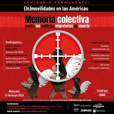
Conversatorio Memoria colectiva contra las políticas migratorias de muerte.
Fecha: 31 de Mayo 2023
POLIFONÍA CRÍTICA
Inspirados/as/es en la cartografía crítica, mapear ha implicado “deconstruir el mapa” (Harley, 1989), o la imagen nítida que da la cartografía tradicional del continente, para sacar a la luz los espacios ocultos, los conflictos no vistos ni captados por la prensa, pero latentes; esos conflictos que deliberadamente quedan por fuera de un mapa tradicional y a la vez de la discusión pública.
REVISTA COMÚN
MAPEO POLIFÓNICO
Una multiplicidad de voces configuran este mapa. Migrantxs de diversas edades, géneros, nacionalidades, procedencias étnicas, orientaciones sexuales, y que viven en varias localidades de las Américas, nos cuentan cómo la pandemia del COVID-19 impacta en sus vidas. A través de sus relatos se constata su experiencia cotidiana de (in)movilidad, confinamiento, de riesgo de enfermedad, su confrontación diaria con la burocracia, la xenofobia, el desempleo; y a la vez, cómo su lucha vital se despliega entre la solidaridad, su fuerza y la esperanza.


Associated Networks


There are two initiatives located on the southern Mexican border linked to the Colegio de la Frontera Sur and the Cátedras CONACYT project, carried out by coordinators Sergio Prieto and Abbdel Camargo.
The Observatorio de Movilidades and Territorios-OMT propose the assessment, consideration, collection and/or systematization of data specifically linked to key aspects of the region, through permanent monitoring of the territory and its (im)mobilities.
The Laboratorio de Investigaciones Transfronterizas-LIT endeavors to overcome state-centric limitations of the traditional definition of “border” through complex and innovative approaches to border territories, pointing to comparative analysis with other global border regions.